Workshopul Internațional Riscuri natuale și antropice
29 septembrie – 01 octombrie 2023
Workshopul de Geomorfologie marchează atât istoric cât si tematic o activitate prodigioasă a geomorfologilor români în cadrul organizat al întâlnirilor ştiinţifice.
Tematica și obiectivele simpozionului
Natural and antropique hazard and risk diagnosis
Techniques and metods
Environmental hazards and risk: sinergy, perspective, management
Others researchs
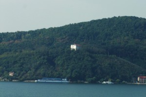
În anul 2023 se împlinesc 59 de ani de la înființarea Stațiunii Geografice Orșova. Statiunea Geograficã Orsova a luat fiintã în anul 1964 prin decizia nr. 654 din 03.05.1964, în localitatea Eşelniţa (subordonată Orşovei) cu scopul de a se efectua cercetãri geografice (de geografie fizică – geomorfologice, hidrologice, climatice, biogeografice, de mediu, de geografie umană și economică) precum și organizării de practici de specialitate pentru studenții geografi, geologi, biologi chimisti, din țară și din străinatate. De-a lungul timpului, Stațiunea Geografică Orșova a Facultății de Geografie, a reprezentat locul de desfășurare a numeroase manifestări științifice: congrese, simpozioane, colocvii, la care au participat cadre universitare din țară și din străinatate.
. . .
The international workshop Natural and anthropic risk
29 September – 01 October 2023
The international workshop marks both historically and thematically a prodigious activity of Romanian geomorphologists in the framework of the scientific meetings.
Aims
Natural and antropique hazard and risk diagnosis
Techniques and metods
Environmental hazards and risk: sinergy, perspective, management
Others researchs
In 2023 59 years were celebrated since the foundation of the Orşova Geographical Station. The Orşova Geographical Station was founded in 1964 through the decision no. 654 of 03.05.1964, in Eşelniţa (belonging to Orşova) with the purpose of developing geographic research (of pysical geography – geomorphological, hydrological, climatic, biogeographical, environmental, of human and economic geography) as well as of organizing specific field applications for students in the fields of geography, geology, biology, chemistry from within the country and abroad.
Orșova Geographical Station is placed in a region where functional relations spread on a multinational territory (the Danube watercourse and its homonymous watershed). Its location within the Danube corridor, the main European axis, is significant both from the scientific and socio-cultural point of view. The Station provides good conditions for carrying out detailed research and for monitoring the quality parameters of the environment within the Danube Defile and its adjacent areas. At the same time, it ensures the proper operation of the Iron Gates Hydropower and Navigation System.
Orșova Geographical Station is an ideal meeting place for the specialists in Romania and abroad, who will be able to approach current issues regarding interdisciplinary or geographical research, in order to come out with appropriate solutions for the sustainable management of the environment.
Abstract book: soon


Danube, the second river from Europe (2857 km.) after Volga, in length as well as in debit, has as source Padurea Neagra Mountains (Germany) and disgorges in Black Sea trough its three channels: Chilia, Sulina si Sf Gheorghe. In its way, passes several mountains, eight countries (Germany, Austria, Czech Republic, Hungary, Serbia, Romania, Bulgaria, Ukraine) and three capital cities (Vienna, Budapest and Belgrade). In our country enters from western Bazias and until the disgorging in the Black Sea has a length of 1075km, which means more than a third from the total length. The most spectacular sector in the Danube gorges is the calcareous zone of Cazane. Here the channel, compressed between vertical walls, is deepest (approximate 100 m), and only 150-200 m broad in some places. Downstream Orsova to Gura Vaii, the Danube flows through crystalline schists, limestones and the Sinaia strata.